openEO
Parcel Delineation based on ML using Sentinel-2
Parcel Delineation
Parcel delineation refers to the identification and marking of agricultural boundaries. This process is essential for tasks such as crop yield estimation and land management. Accurate delineation also aids in classifying crop types and managing farmland more effectively.
Algorithm for Parcel Delineation Using Sentinel-2 Data
This algorithm performs parcel delineation using Sentinel-2 data and a pre-trained U-Net machine learning model. The process involves the following steps:
- Pre-processing Sentinel-2 Data:
- Filter data to ensure a maximum of 10% cloud coverage.
- Apply a cloud mask based on the SCL layer.
- Compute NDVI:
- The Normalized Difference Vegetation Index (NDVI) is calculated from the pre-processed data.
- The NDVI serves as input to the U-Net model.
- Predict Delineation:
- The U-Net model predicts parcel delineation boundaries.
- Optimization and Labeling:
- Apply a Sobel filter to enhance edge detection.
- Use Felzenszwalb’s algorithm for segmentation and labeling of delineated parcels.
Preview
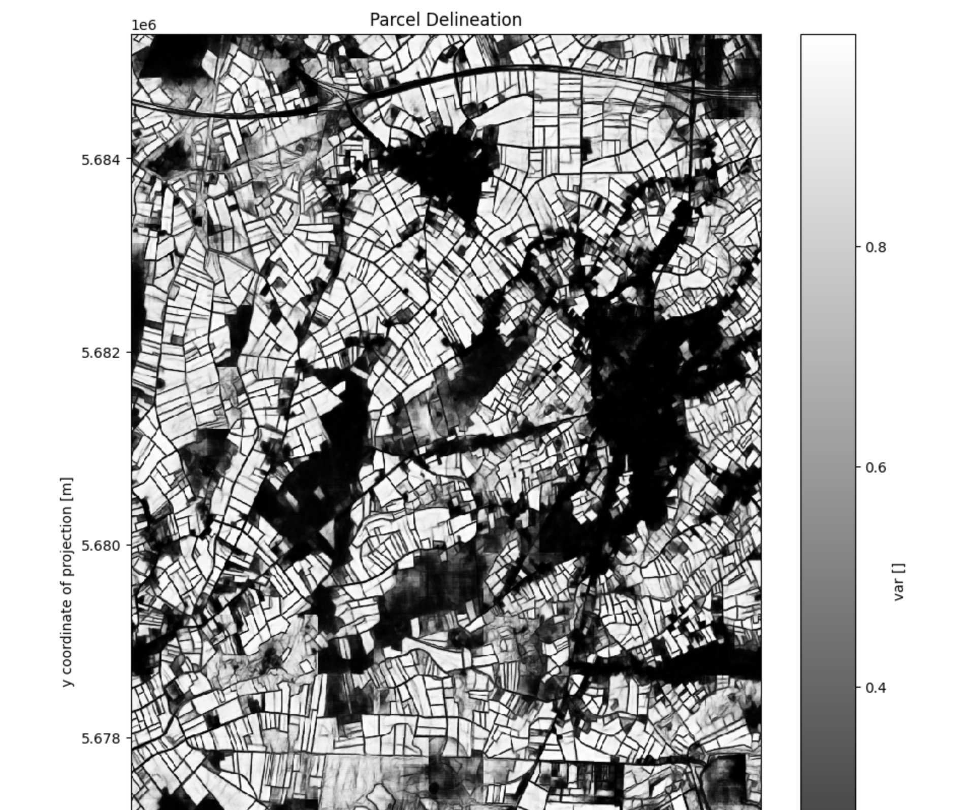
Parcel Delineation
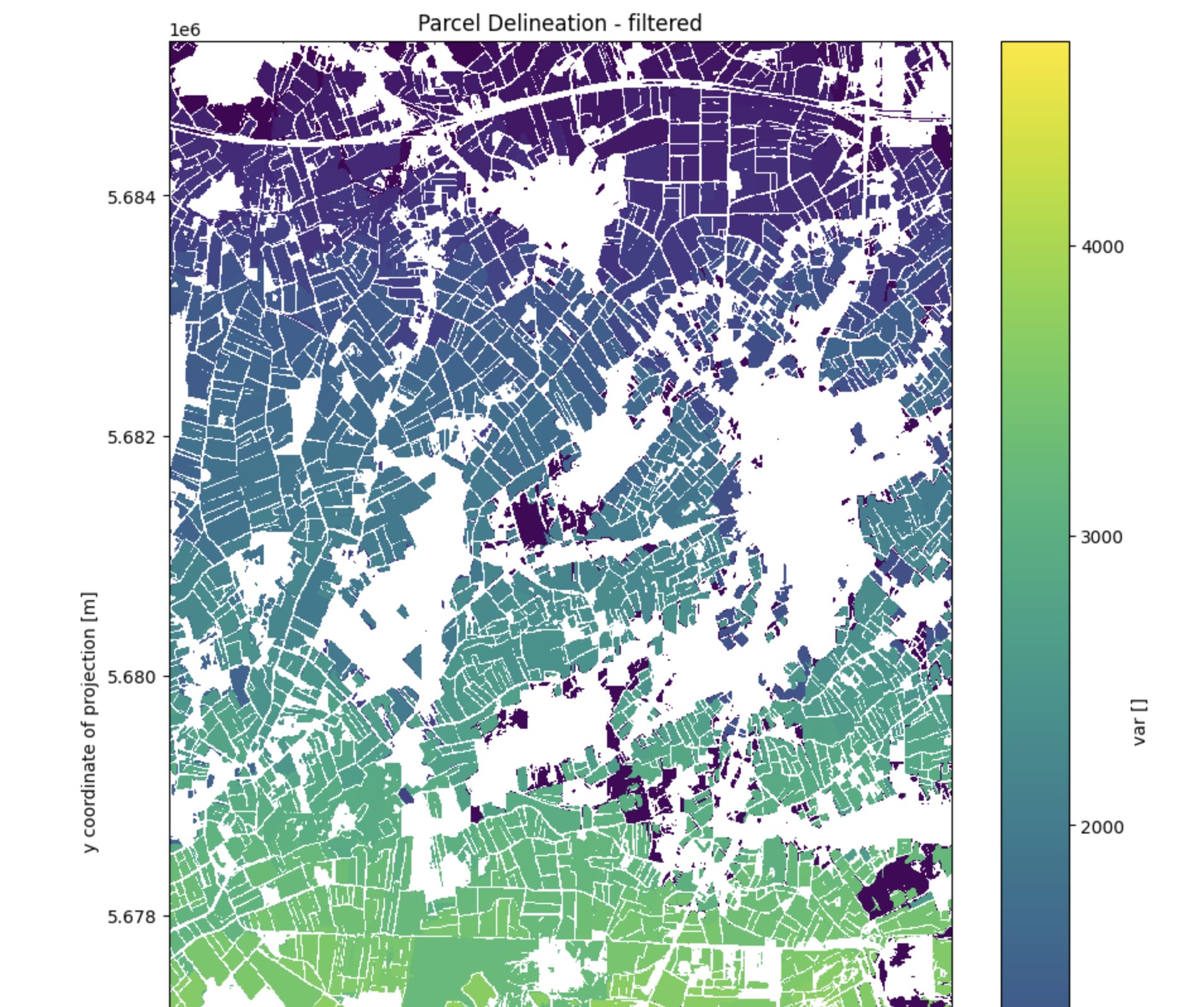
Parcel Delineation - Filtered